Laugavegur
A legendary itinerary to the far north
54 Km, 4 days | Iceland.
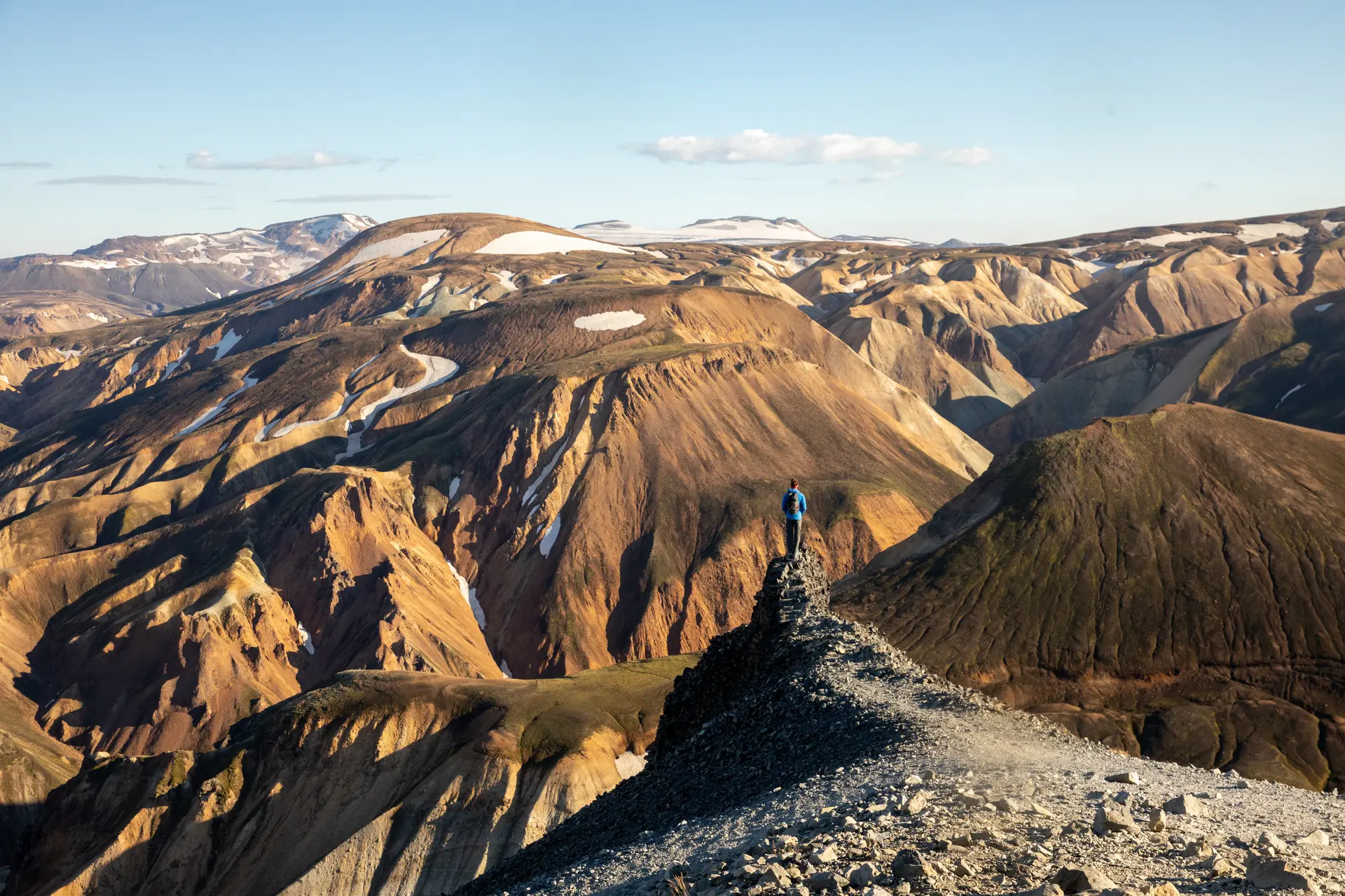
Set amidst breathtaking scenery of glaciers, hot springs and majestic volcanoes, Laugavegur is a trail that embodies the untamed spirit and wild beauty of Iceland. This legendary trail, some 54 km long, passes through some of the island’s most spectacular natural wonders, providing a unique and unforgettable trekking experience.
Prepare to admire incredible panoramas, where imposing expanses of ice merge with couloirs of dark volcanic rock, while steaming hot springs are a reminder of the intense geothermal activity that shapes this extraordinary landscape. The Laugavegur will take you through a land of extremes, where nature reigns supreme and where every step is an immersion in the wonders of this remote Icelandic region.
Transportation
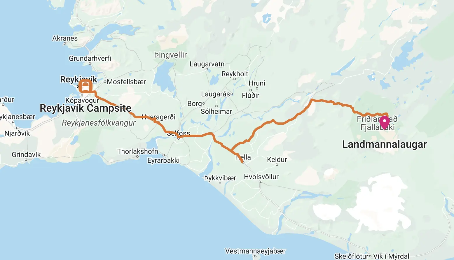
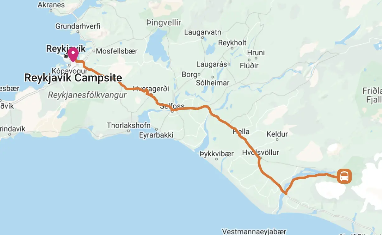
The starting point of the route is Landmannalaugar, which is about 180 km from Reykjavik and can only be reached in summer and via mountain roads. The easiest way to get there is to take a bus, and below are some possible options:
Another very convenient option is to book a package that includes both the outward journey and the return journey (starting from the end point of the Trail): there are some agencies that allow you to book pass such as Trex, with the Hiker Bus Pass.
Another agency that allows you to book buses to and from Laugavegur is Volcano Trails.
Itinerary and stages
Stage 1 – Landmannalaugar to Hrafntinnusker:.
12 Km | 4/5 hours | +470m
It is the shortest stage, but also the one with the greatest uphill elevation gain, which is why many people find this stage quite strenuous. The first part of the trail leads up to and through the Laugahraun lava field, continuing downhill and back to a plateau. At this point the trail heads toward Stórihver, next to a fantastic geyser. From here to the Höskuldsskáli hut (at Hrafntinnusker) is only an hour away, but this last part is often covered in snow and therefore requires greater effort and attention.
Stage 2 – Hrafntinnusker to Álftavatn:
12 Km | 4/5 hours | -490m
This day begins in a valley that is mostly flat, but there are a couple of ravines that must be crossed very carefully. Along this stage, if weather conditions permit, an extension to Háskerðingur (1-2 hours more), which allows for beautiful views. Now we proceed to Jökultungur, from where we can see the three fantastic glaciers Tindfjallajökull, Eyjafjallajökull and Mýrdalsjökull. In this section the road is quite rocky and may be covered with snow. At the end of Jökultungur you have to cross the Grashagakvísl River (either on a snow bridge or by fording it) and continue to the Álftavatn Lake shelter.
Stage 3 – Álftavatn to Emstrur:
16 Km | 6/7 hours | -40m
The trail heads east in the direction of Hvanngil. It is necessary to cross the river Bratthálskvísl, which has no bridge and must be forded on foot. Once you get to Hvanngil you can find restrooms for hikers. Now continue by crossing the Kaldaklofskvísl River on a bridge and then crossing the Bláfjallakvísl River (this time fording it on foot). The route from this point on almost always follows the main road, until you reach the Innri Emstruá River, which you can cross on a bridge. At this point we head toward Emstrur, where the landscape is almost devoid of vegetation. The lodges here are not visible until you are very close to them.
Stage 4 – Emstrur to Þórsmörk:
15 Km | 4/5 hours | -300m
On this last stage, the trail starts heading east and soon reaches the bridge over the river Syðri-Emstruá. The river ends in a deep canyon, and people suffering from vertigo might be afraid to cross the bridge, as it passes right over it. From here, the path heads towards the confluence of the rivers Markarfljót and Syðri Emstruá and it is recommended to follow the path to the edge of the gorge, before heading south through Almenningar. Now the route crosses two small ravines, inside each of which there is a stream of drinking water. We then head towards Fauskatorfur and Úthólmar, where more vegetation will begin to be present again. The last climb of the Laugavegur, called Kápa, remains to be covered, at the end of which the Þröngá river must be crossed. It takes half an hour to reach Þórsmörk, the end of this path.

Where to sleep
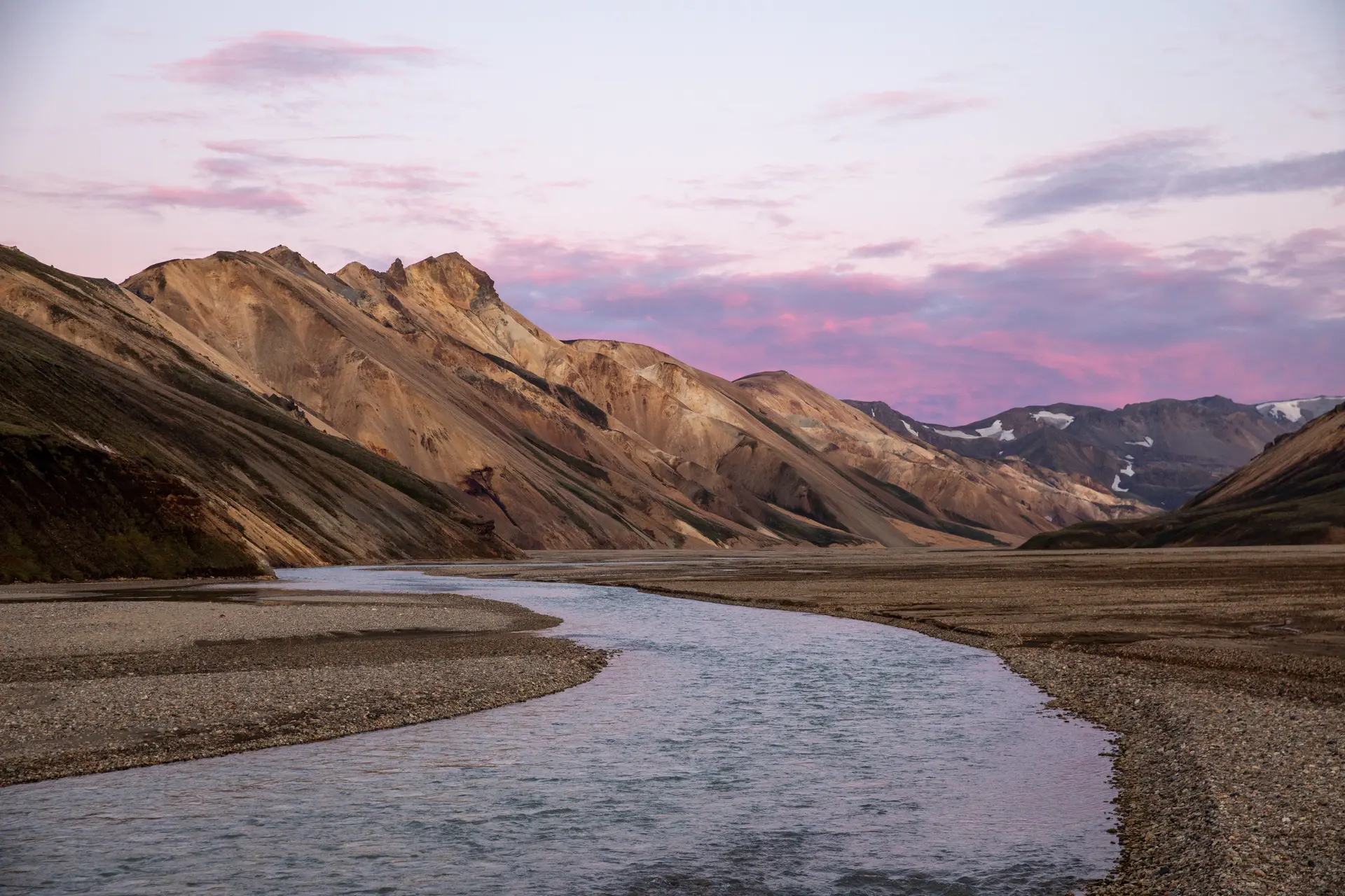
Those who decide to embark on the spectacular hikes of the Laugavegur Trail and the Fimmvörðuháls Trail in Iceland can count on an excellent network of shelters and equipped rest areas, scattered along these scenic routes. Most of these facilities are managed by the FI association, which is committed to promoting local hiking tourism; But there is no shortage of private solutions such as campsites and shelters in Þórsmörk, Fimmvörðuskáli and Skogar.
Facilities along the Laugavegur offer sleeping spaces in communal dormitories (bring sleeping bags), fully equipped kitchens for preparing meals, toilets and usually hot showers (except at Hrafntinnusker). They are manned by experienced caretakers, always ready to assist hikers. Inside you will also find small shops to buy some food supplies and trekking articles.
To use the Laugavegur Trail huts it is absolutely necessary to book well in advance, as places sell out quickly at peak times: reservations can be made directly from this link, sending an availability request for the huts and dates required.
Below is a table with the characteristics of the various huts stage by stage:
Hrafntinnusker Hut
- 52 beds;
- GPS: N 63°56.014 – W 19°10.109;
- TEL: 499 1035;
- website.
Álftavatn Hut
- 72 beds;
- GPS: N 63°51.470 – W 19°13.640;
- TEL: 499 0721;
- website.
Emstrur Hut
- 60 beds;
- GPS: N 63°45.980 -W 19°22.450;
- TEL: 499 0647;
- website.
Þórsmörk / Langidalur Hut
- 75 beds;
- GPS: N 63°40 960 – W 19°30.890;
- TEL: 893 1191;
- website.
Many hikers also decide to camp along the Laugavegur: we are working on a more detailed guide to this, but in the meantime powerful take a look at this article, which explains the topic very well.
Supplies and Meals on Laugavegur
Hiking the Laugavegur Trail requires careful planning with regard to food and water. Along this wonderful trail, opportunities for a hot meal are decidedly limited. The only exceptions are the restaurant at the hut run by Volcano huts.
Most shelters offer a very limited choice of food for sale (usually packaged snacks, chips, noodles, soft drinks, …), and at a rather high cost; The most practical and economical solution is to stock up in Reykjavik before setting out on the trek, buying everything you need for the entire excursion: food, fuel for camping cookers and whatnot.
For cooking needs, you will not necessarily have to equip yourself with stoves and camp equipment, as all the huts along the route have fully equipped kitchens available for guests.
One last tip: before leaving each hut, remember to stock up on drinking water for the entire day’s walk. Although this is available in all facilities, external water sources may not always be reliable or healthy.
Videos and Useful Resources
It might be useful to watch some videos (here we have prepared a playlist of interesting videos) to find out some additional information about the Laugavegur. Click on this link to see the playlist on Youtube.
For up-to-date information on the Laugavegur, the various huts and opening times, visit the following sites:
Other very convenient sites for planning the itinerary are the following:
- The Complete Guide to the Laugavegur Trail | Map, Routes, and Itineraries – TMBtent;
- The Complete Travel Guide to the Laugavegur Trail (explorerspassage.com);
- A Guide to Hiking The Laugavegur Trail in Iceland (muchbetteradventures.com);
- Complete Guide to Hiking Laugavegur Trail in Iceland (adventures.is).
Laugavegur Trail guides:
Listed below are some of what we think are the best guides and maps for Laugavegur. There are not many of them, but they are useful for better planning one’s path:
When to hike it
Usually the route is open from June 25 to September 15, however, it may vary depending on the specific conditions of each period and depending on when the Icelandic authorities open the roads to Landmannalaugar and the various shelters.
A key aspect to build on is the opening of the roads to Landmannalaugar and the other shelters on the way (F208/F225/F210), which can be checked on this link.
Iceland is known for its unpredictable and often extreme weather, and whichever month you choose (always in the summer) to embark on the Laugavegur Trail, it is essential to be prepared for difficult weather conditions, with cold, rain and wind that can occur unexpectedly during the walk, so proper equipment is essential.
Whatever the period chosen, it is always essential to check with the staff at the huts for the latest weather conditions and to avoid setting out in the event of dangerous conditions.
Markers
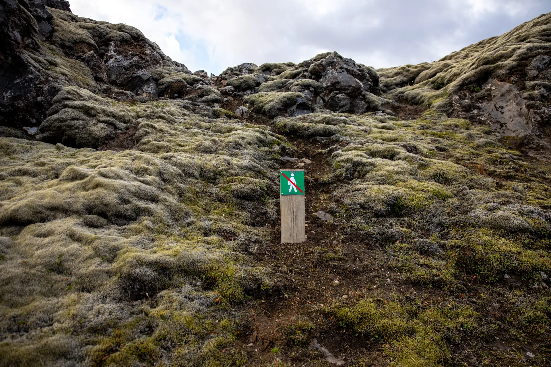
The Laugavegur is a well-marked route and busy enough not to cause any particular fear for those who tackle it well prepared; However, you should bear in mind that you are entering a high mountain environment, where weather conditions can change abruptly.
On days of bad weather and poor visibility, finding your way around can become a challenge, especially in the early sections, where fog and snow residue is often common in the early summer months.
To best deal with these situations, it is advisable to have a portable GPS or GPS tracks installed on your smartphone; These tools will guide you safely, preventing you from getting lost along the way.
Remember that the trail reaches altitudes of over 1,200 metres, so it is not out of the question to face sudden showers or snowstorms even in the height of summer.
In some places you will have to wade through small streams, as there are no footbridges. Nothing particularly challenging, except for sudden swellings due to rain or thaw. Cross them carefully, using the current in your favour.
Finally, it should be noted that mobile network coverage is rather sporadic.
Other routes you might like
Fishermen’s Trail, Rota Vicentina
Nestled in the spectacular Costa Vicentina, the Fishermen’s Trail offers breathtaking views and pristine beaches along the Rota Vicentina. Learn more about one of the most beautiful coastal paths in the world.
The Camino de Santiago in 10 days
Discover the Camino de Santiago in 10 days from Astorga, walking the last 260 km, crossing fantastic landscapes and meeting unique people.
Cammino del Salento – Seaside Path
Discover the Cammino del Salento and its Via del Mare, 115 km of walking almost entirely along the coast of the Adriatic Sea

0 Comments